

European Cross-Border cooperation - INTERREG
For more details on INTERREG Cross-Border Cooperation Programe, please follow this link: – INTERREG A - Cross-border cooperation
Bulgaria has 5 eligible cross-border regions, developed as separate bilateral programs for the period 2014-2020, under the basic EU INTERREG program:
- Bulgaria-Romania;
- Bulgaria-Greece;
- Bulgaria-Serbia;
- Bulgaria-Macedonia;
- Bulgaria-Turkey;
Under the flagship project SPATIAL – MIS ETC 171, financed by the Trans-border cooperation program Romania-Bulgaria 2007-2014, ASDE has developed the first in EU cross-border spatial databases(SDB), integrated and harmonized under the Directive 02/2007/EU – INSPIRE and based on a reference land cover layer, realized under the ISO 19144-2 (LCML) standard. The whole territory is about 72 000 km2. We have started preparing regularly analysis on the Bulgarian part of the Cross-Border Territory as follows:
| NAME, Latin | CODE, National | AREA, in SqKm |
|---|---|---|
| Vidin | VID | 3042.69 |
| Montana | MON | 3631.25 |
| Vratsa | VRC | 3624.6 |
| Pleven | PVN | 4652.16 |
| Veliko Tarnovo | VTR | 4659.48 |
| Ruse | RSE | 2865.37 |
| Razgrad | RAZ | 2411.58 |
| Silistra | SLS | 2849.61 |
| Dobrich | DOB | 4713.53 |
| Total Area | 32 450.27 | |
Riskwatch thematic floods risk management maps on Cross-Border area, for the period of three years from 2012 up to 2014
These maps are based on data mining Riskwatch system, comprising aggregated RSS - data.| Map of the Registered Floods-messages in 8-months, in a three year period – 2012, 2013, and 2014 | 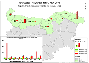 |
| Map of the Registered Floods-messages in 8-months, over Total registered for the three year period, on a district | 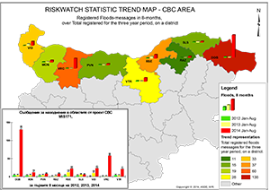 |
| Map of the Registered Floods-messages in 8-months, in a three year period,over total Population for a district | 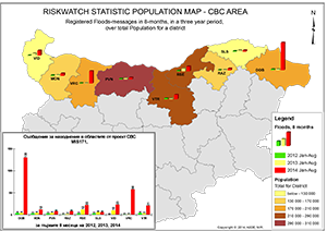 |
| Map of the Residential Buildings - structure types representation, over the Total registered flood messages for the three years period, on a district | 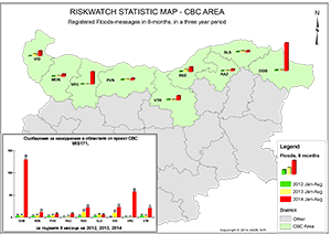 |
